Reef Fish Survey
Housed at the Marine Resources Research Institute (MRRI) of the South Carolina Department of Natural Resources (SCDNR), SEAMAP-SA Reef Fish Survey (RFS) is part of a collaborative, region-wide reef fish sampling program that was initially started by The Marine Resources Monitoring, Assessment and Prediction (MARMAP) program in 1972. SEAMAP-SA RFS conducts fishery‐independent research on the continental shelf and shelf edge between North Carolina and Florida, to determine the distributions, relative abundances, and critical habitats of economically and ecologically important fishes off the southeast United States’ coast, and to relate these features to environmental factors and exploitation activities.
Survey Design
Current survey efforts focus on two types of habitats for snapper-grouper species in the region: hard-bottom sampling, and soft-bottom sampling. Hard-bottom sampling is done using chevron traps or short bottom longlines while soft-bottom sampling is conducted with long bottom longlines.
The hard-bottom sampling area includes waters of the continental shelf and shelf edge between Cape Hatteras, NC, and St. Lucie Inlet, FL (Fig. 1). Throughout this range, we sample stations from a universe of confirmed hard-bottom sites (monitoring) mid-April to mid-October. Gear deployments on suspected hard bottom each year (reconnaissance) are evaluated based on catch and video or photographic evidence of bottom type for inclusion in the sampling universe the next year. Two types of reef habitat stations are available for sampling each year: low to moderate relief via chevron trap and moderate to high relief via short bottom longline (SBLL; Smart et al. 2015). Each year, a subset of stations are selected randomly from the universe in a manner such that no station selected in a given year is closer than 200 m to any other selected station (Smart et al. 2015). In 2021, there were approximately 4,500 reef habitat stations in the sampling universe for chevron traps, ranging in depth from 15 to 110 m, although most stations are generally shallower than 100 m. In 2021, there were approximately 390 SBLL stations, with depths ranging from 75 to 360 m, with most stations found deeper than 100 m. Chevron trap stations and SBLL stations are randomly selected separately, as there is very little spatial overlap between these sampling universes.
Long bottom longlines (LBLL) are deployed over soft-bottom areas (sand or mud) off South Carolina and Georgia. Rather than stations, LBLL deployments are conducted within 15 blocks of confirmed soft bottom (each block covers between 50 and 65 km²; Fig. 1). The goal is to deploy a minimum of 2 LBLL monitoring deployments within a given block each year and the minimum distance between these deployments is 200 m. Exact locations of deployments within a block are determined by weather conditions and current direction and speed. LBLLs are deployed at depths between 160 and 300 m. Sampled LBLL blocks are referred to as monitoring events while exploratory sampling for new soft bottom is referred to as reconnaissance events.
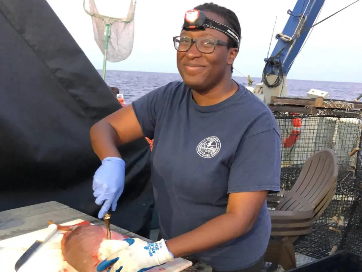
Data collected from all gears include location, depth, time and for all collected fish abundance, biomass, and lengths. For managed fish of ecological importance detailed lengths, weights, age, and reproductive characteristics (Table 1, 2).
The chevron trap survey has been adopted by an additional partner program within the region, the Southeast Fishery Independent Survey (SEFIS) at the Southeast Fisheries Science Center. The combined chevron trap efforts of SCDNR RFS and SEFIS, with funding through NOAA, MARMAP, and SEAMAP-SA fall under the umbrella of the Southeast Reef Fish Survey (SERFS).

Chevron Trap
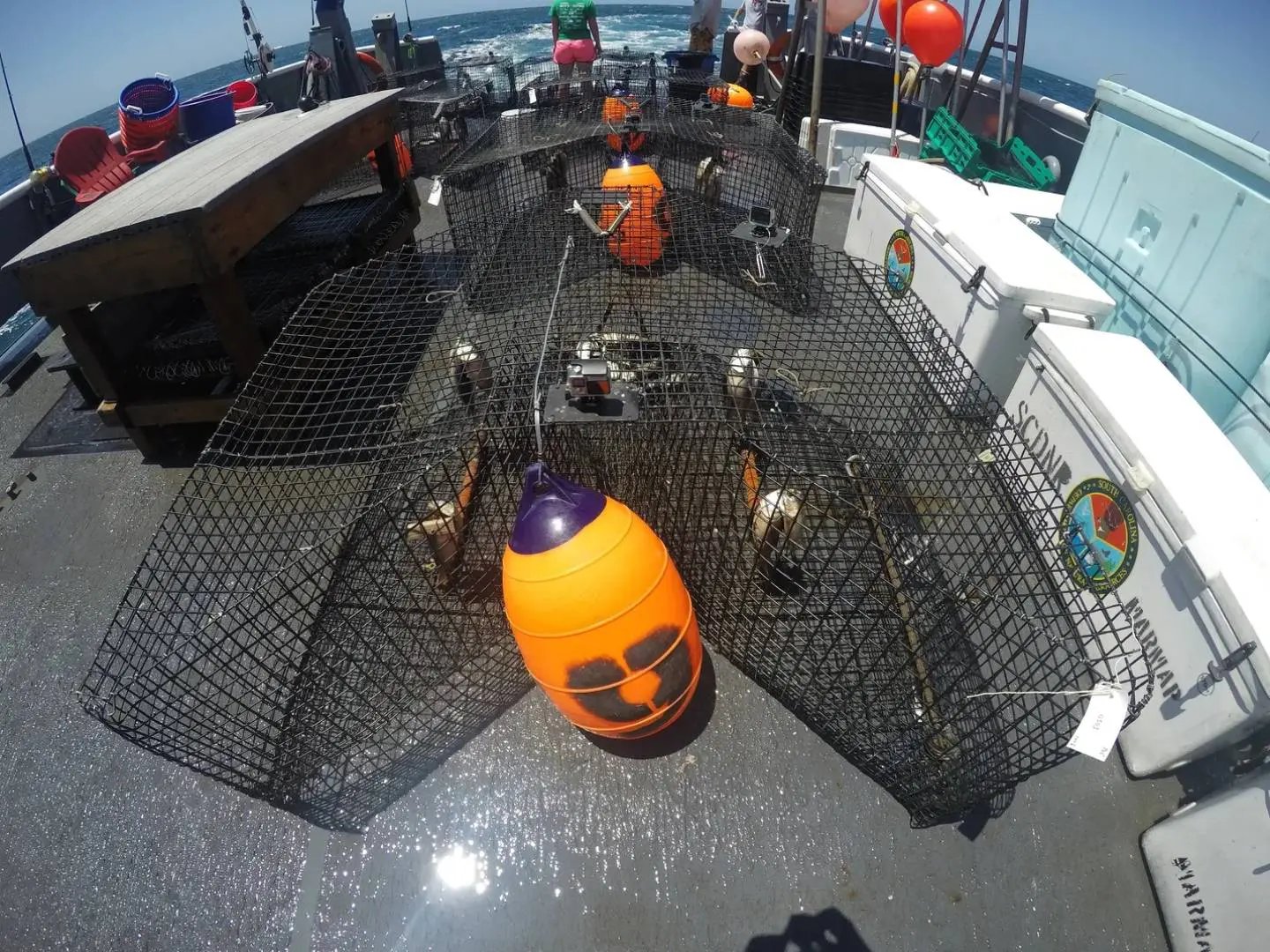
The standardized chevron trap time series is continuous from 1990 to present, was originated by MARMAP, and later adopted by SEAMAP-SA RFS and SEFIS, at which times distribution and extent of sampling expanded (notable expansions during 1996 and 2010). Chevron traps are arrowhead shaped, with a total interior volume of 0.91 m³ (Fig. 1). Each trap is constructed of 35 x 35 mm square mesh plastic‐ coated wire. Each trap possesses a single entrance funnel (“horse neck”) and release panel to remove the catch. Prior to deployment each chevron trap is baited with a combination of whole or cut clupeids, with Brevoortia spp. most often used. Four whole clupeids on each of four stringers are suspended within the trap and approximately 8 clupeids, with their abdomen sliced open, are placed loose in the trap. An individual trap is attached to an appropriate length of 8 mm (5/16 in) polypropylene line buoyed to the surface using a polyball buoy. We attach a 10 m trailer line to this polyball buoy, with the end of the trailer line clipped to a polyball buoy.
Generally, traps are deployed in sets of six when enough stations are available in the sampling area, with a minimum distance of 200 m between traps. Traps are retrieved in chronological order of deployment, using a hydraulic pot hauler, after an approximately 90-minute soak time. All chevron trap deployments occur during daylight hours (no earlier than 30 minutes after sunrise and retrieved no later than 30 minutes before sunset). For each set of traps deployed, a conductivity, temperature, and depth instrument (CTD) is deployed to measure hydrographic variables.
Short-bottom longline (SBLL)
SBLLs are bottom longlines that are deployed over moderate to high-relief live bottom and are shorter than our other type of longline gear (see LBLL description). SBLLs were first deployed by the MARMAP program in 1979, with a standard methodology since 1996. The SBLL consists of 25.6 m of 6.4 mm diameter treated solid braid Dacron (polyester) ground line dipped in green copper naphthenate. We attach twenty gangions to this ground line at intervals of approximately 1.2 m. The gangions consist of an AK snap, 0.5 m of 90 kg monofilament and a non-offset circle hook (almost exclusively #5 Eagle claw size) baited with a whole squid (Illex sp. or Loligo sp.).
The line is deployed by stretching the ground line along the vessel's gunwale with 2-3 sash weights (ca. 4.5 kg each) attached at each end of the line. Each ground line is attached to an 8 mm (5/16 inch) polypropylene line buoyed to the surface using a polyball buoy. The buoy is attached to a second polyball buoy using a 10 m trailer line. Longlines are not attached to each other or the ship. Soak time is approximately 90 minutes, after which the gear is retrieved utilizing a hydraulic pot hauler. The SBLLs are generally deployed in sets of six, with a minimum distance between longlines of 200 m. All SBLL deployments occur during daylight hours (no earlier than 30 minutes after sunrise and retrieved no later than 30 minutes before sunset). For each set of SBLLs deployed, a conductivity, temperature, and depth instrument (CTD) is deployed to measure hydrographic variables.
Long-bottom longline (LBLL)
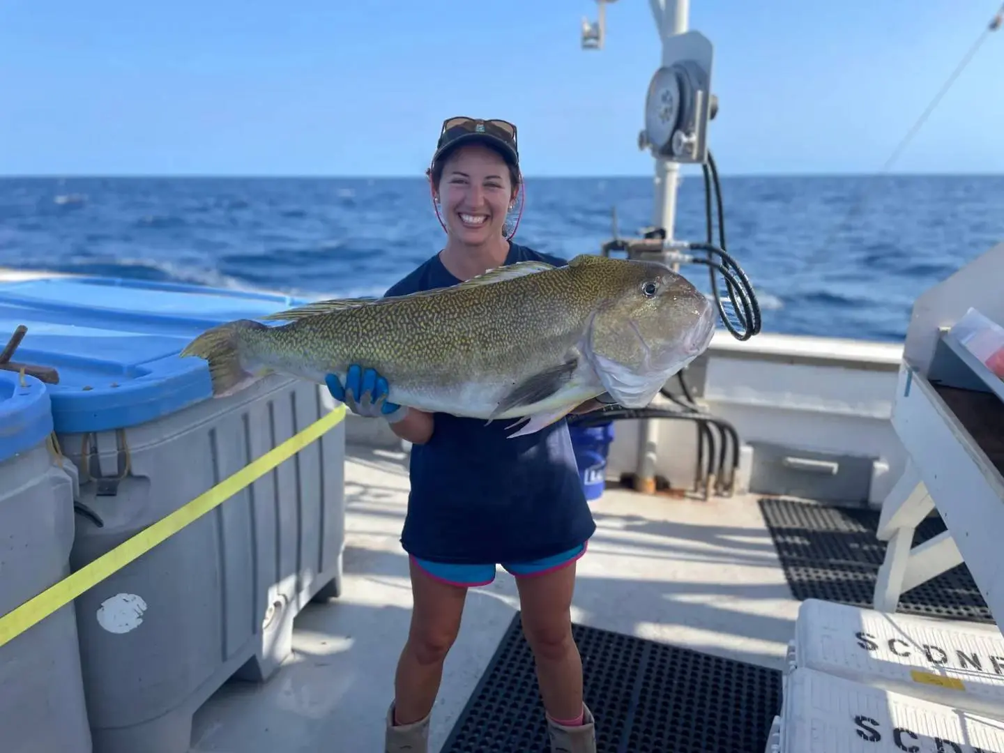
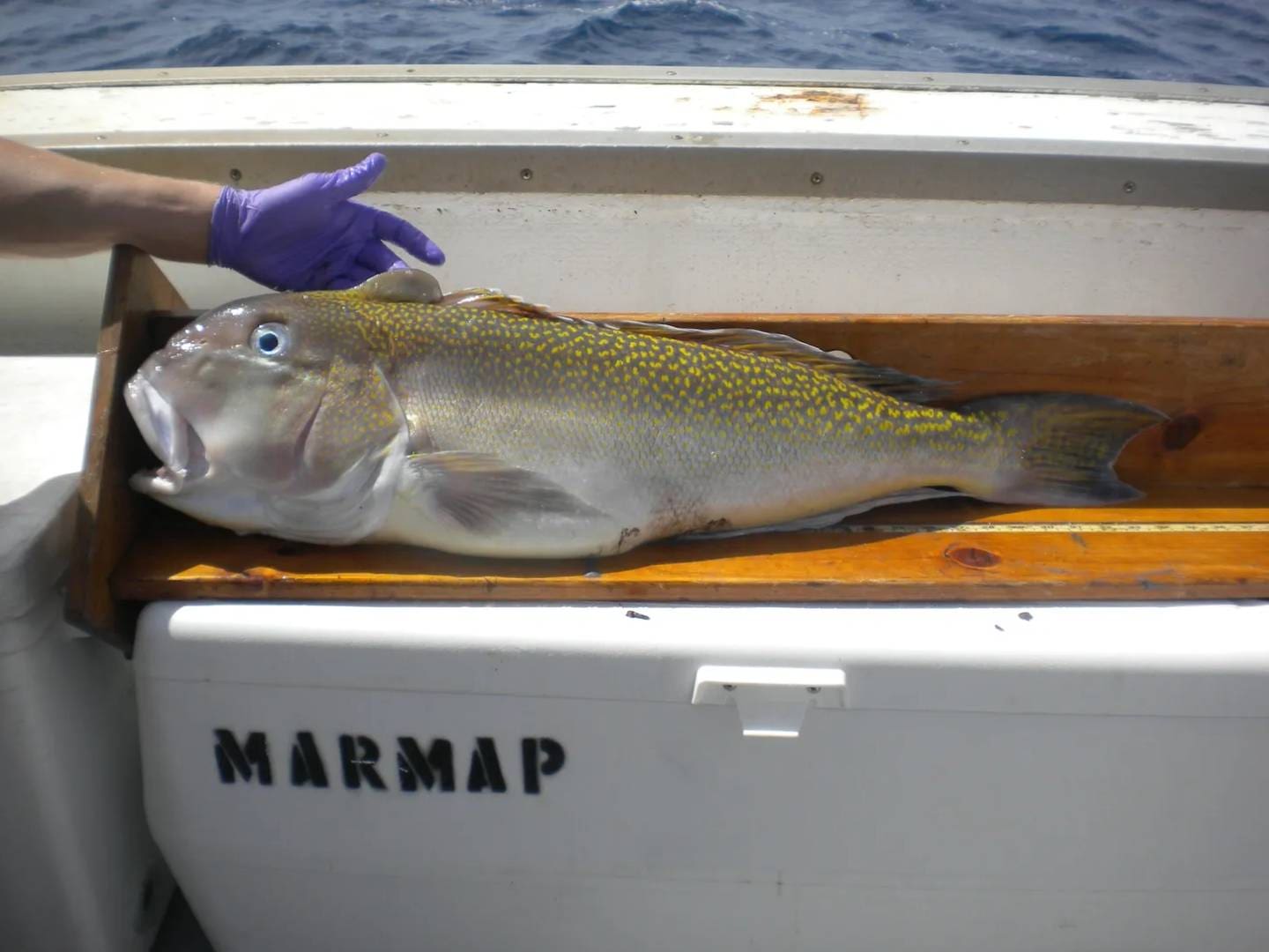
The LBLL was initiated in the early 1980’s to sample the snapper-grouper species in the tilefish grounds (primarily Golden Tilefish, Lopholatilus chamaeleonticeps), which are typically composed of smooth mud or sand bottom. Since 1996 LBLLs have been constructed of 3.2-mm galvanized cable (1,525 m long), deployed from a longline reel, with 1,220 m of the cable used as the ground line and the remaining 305 m buoyed to the surface. Two to three sash weights (10-11 kg each) are attached to the leading end of the ground line and 100 gangions are attached in 12 m intervals to the ground line. Gangions consist of an AK snap, approximately 0.5 m of 90 kg monofilament, and a non-offset circle hook (almost exclusively #5 Eagle claw size). Another 2-3 sash weights are attached at the terminal end of the ground line (buoy end) and the remaining 305 m of cable is buoyed to the surface with 1 or 2 polyball buoys and an additional 1 or 2 polyball buoys attached to a 10 m trailer line. Hooks are baited with whole squid (Illex sp. or Loligo sp.).
LBLLs are deployed while running with the current at a speed of 4-5 knots, with two LBLLs in a set. Each line soaks for 90 minutes and is retrieved using a hydraulic pot hauler. All LBLL deployments occur during daylight hours (no earlier than 30 minutes after sunrise and retrieved no later than 30 minutes before sunset). For each set of LBLLs deployed, a conductivity, temperature, and depth instrument (CTD) is deployed to measure hydrographic variables.
CTD
Oceanographic data is collected via a conductivity, temperature, and depth instrument (CTD) to complement most gear deployments. For each set of gear deployed, a CTD is deployed to measure depth, temperature, and salinity. SeaBird SBE 19, 25, and 25Plus CTDs have been used at various time points within the time series, but all sensors are regularly calibrated to allow each instrument to provide comparable measurements. All CTDs measure depth, temperature, and salinity, but the 25 and 25Plus are equipped with additional sensors such as dissolved oxygen, chlorophyll, nitrates, and phosphates. CTD casts are conducted while sets of either chevron traps or SBLLs are soaking and prior to or following each LBLL deployment. Only data from down casts are archived.
Future Research Goals
The SEAMAP-SA Reef Fish Survey will continue to provide long-term, fishery-independent data on the distribution and relative abundance of reef fish in the Southeast region. The SEAMAP-SA RFS will continue to provide life history data and samples for species of management and ecological importance.
Data Acknowledgment and Data Caveats
The preceding survey design descriptions are included to assist the data user in acquiring a thorough understanding of the survey before querying the SEAMAP-SA database within the SECOORA portal.
The data user is responsible for reading and fully comprehending every aspect of the requested data. Each requestor is solely accountable for their data analyses and/or data manipulations following download. It is also the responsibility of the data user to cite and acknowledge SEAMAP-SA and the Southeast Reef Fish Survey (SERFS) as the data collectors and providers.
")